Maps
This page contains some maps that could be useful in our saga. Since our covenant is built on Calf of Man, these maps will be mostly of British Isles. Clicking on the thumbnails will show you the big picture. A word of warning though: the maps are big - both in resolution and in size.
Then another thing. If you're interested in more maps (especially historical which are very hard to come by, you should check out the University of Texas, map archives. Their library is so large and contains many useful maps of the europe in 1200.
 |
 |
 |
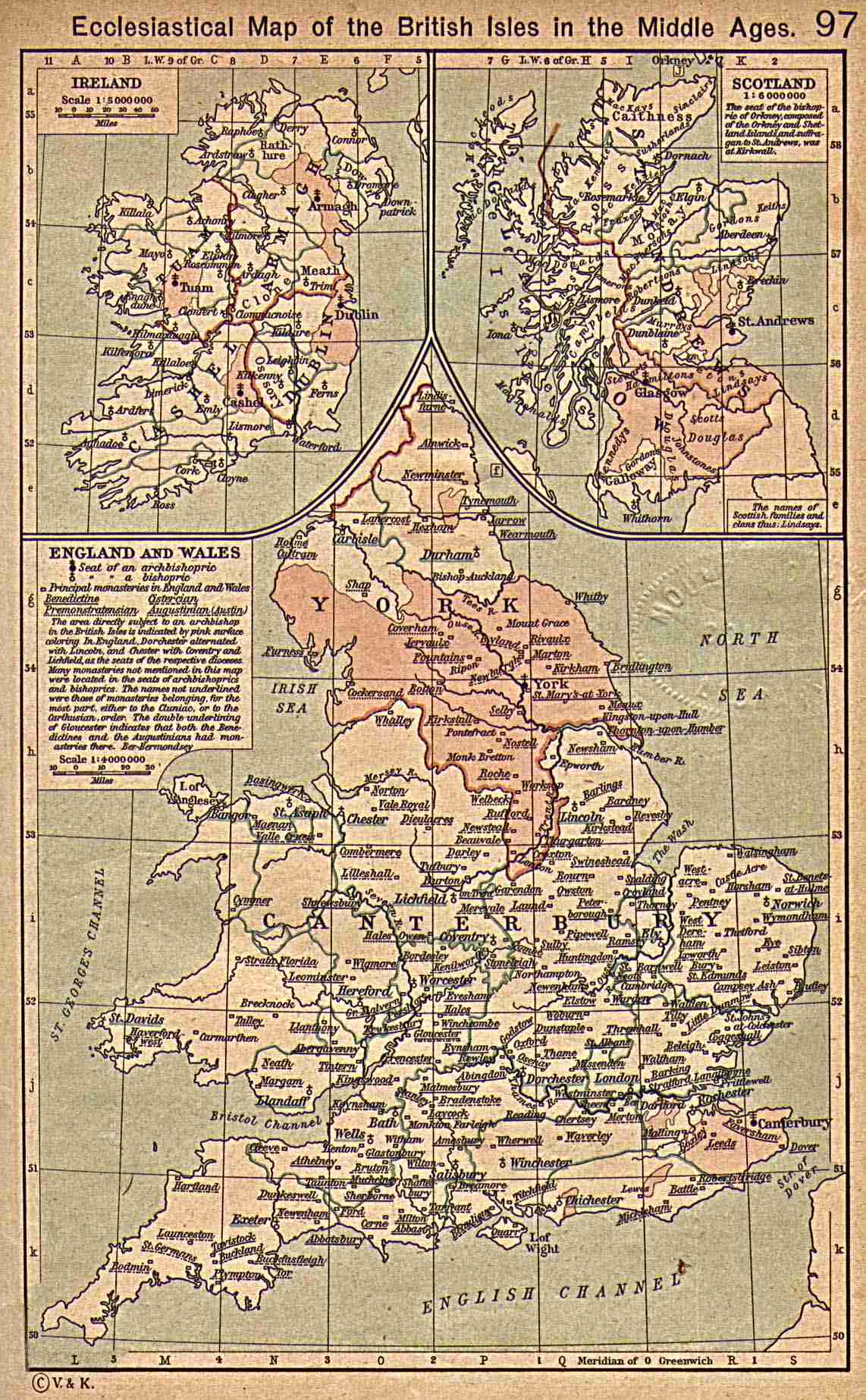
This map is labeled Ecclestial Map of British Isles in the Middle Ages. It shows England, Scotland, Ireland and Wales. Map size: 1142x1846x24b, 263kb |
This map shows Ireland in the year 1808. It also shows a bit of Scotland and Wales, and, of course, the Isle of Man. Map size: 1614x1499x24b, 225kb |
This map shows the universities in the medieval Europe. For some of the "newer" ones it also shows the founding year. Map size: 1127x986x24b, 174kb |
 |
 |
 |
This map shows the British Isles in 1300. Map size: 1147x1808x24b, 306kb |
This is a physical map of the British Isles, showing altitudes, forests and swamps. Map size: 1236x1866x24b, 300kb |
This map shows the Mediterranean in 1204, and the paths of the crusades. Map size: 1889x932x24b, 291kb |
 |
 |
 |
This old map shows the Isle of Man. As you can see, it's not precise, but it suits in the saga well. Map Size: 573x800x4, 46kb GIF |
This map shows the Isle of Man and a small Calf of Man below it. The resolution is not too great, but still... a welcome addition to this gallery. Map size: 490x366x24b, 143kb JPG |
Also this big map shows the Isle of Man and small Calf of Man. It spans a few screenfuls. You've been warned. Map Size:1092x2000x24b, 333kb JPG |
 |
 |
 |
This is a modern map of the Isle of Man, with the major cities shown. Map Size: 280x346x256, 67kb GIF |
An older map of Man. Map Size: 652x840x256, 23kb JPG |
Map of the parishes of Isle of Man. Map Size: 450x500x256, 30kb GIF |
 |
 |
 |
The map of europe in 1100 AD. 1203x960x24b, 283kb |
The map of europe in 1200 AD. 1203x960x24b, 276kb |
|
 |
 |
 |
Calf of Man with the buildings, farmland and most important places marked. Map Size: 1117x1143x256, 124kb JPG |
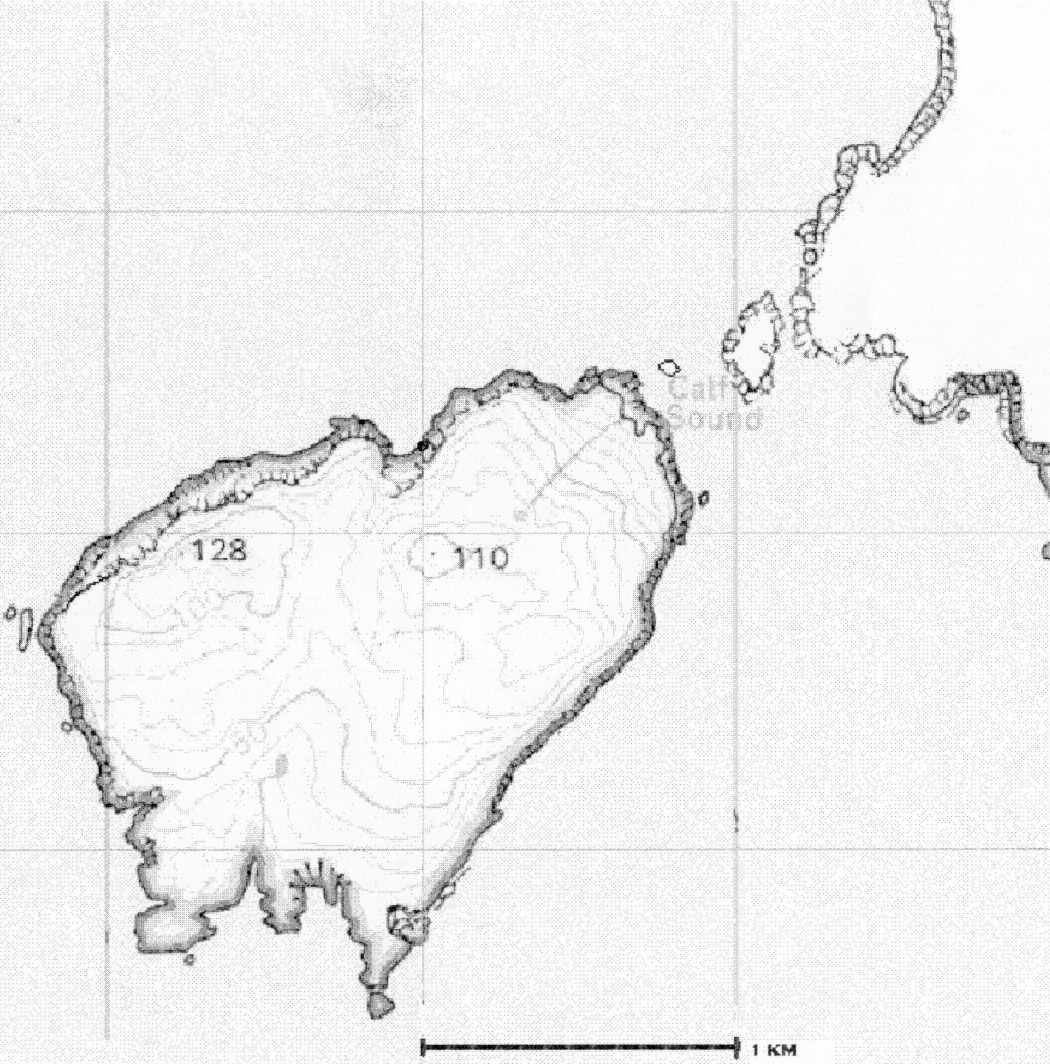
Another Calf of Man, this one without markings. Map Size: 1050x1064x256, 105kb JPG |
The map of our covenant. Shows the Calf of Man, a small bit of Isle of Man and the main buildings on our island. Map Size: 568x520x128, 38kb GIF |
 |
||
Map of mythic Scotland, with major cities and covenants shown. Map Size: 938x1474x256, 175kb JPG |